
This Map Coordinates MOD APK provides a premium experience by unlocking specialized navigation tools and coordinate systems typically reserved for paid users. The build eliminates all integrated advertisements and tracking services while granting full access to professional measurement features and advanced coordinate types like MGRS and UMT.
What’s Modified in Map Coordinates
- MGRS coordinates type unlocked for professional mapping use
- UMT coordinates type unlocked for expanded geographic data
- Remove Ads functionality unlocked to provide an uninterrupted interface
- Measurement Tools unlocked for precise distance and location calculations
- Disabled or removed unwanted Permissions, Receivers, Providers, and Services
- Optimized and zipaligned graphics with cleaned resources for faster application loading
- Ads Permissions, Services, and Providers removed from the Android.manifest file
- Ads links removed and associated invoke methods nullified to prevent background requests
- Ads layouts visibility disabled within the user interface
- Google Maps Location functionality remains fully operational
- Debug code removed to streamline the application package
- Default .source tags name of the corresponding java files removed
- Analytics, Crashlytics, and Firebase tracking services completely disabled
- No active trackers or advertisements present in the build
- Full Multi-Language support included for global accessibility
- Support for multiple screen DPIs including 120dpi, 160dpi, 240dpi, 320dpi, 480dpi, and 640dpi
- Original package signature changed
 |
 |
This build is version 5.8.4, has a file size of 13M, and uses the package name sands.mapCoordinates.android; it is re-signed and cannot be installed over an existing version from the store.
About Map Coordinates
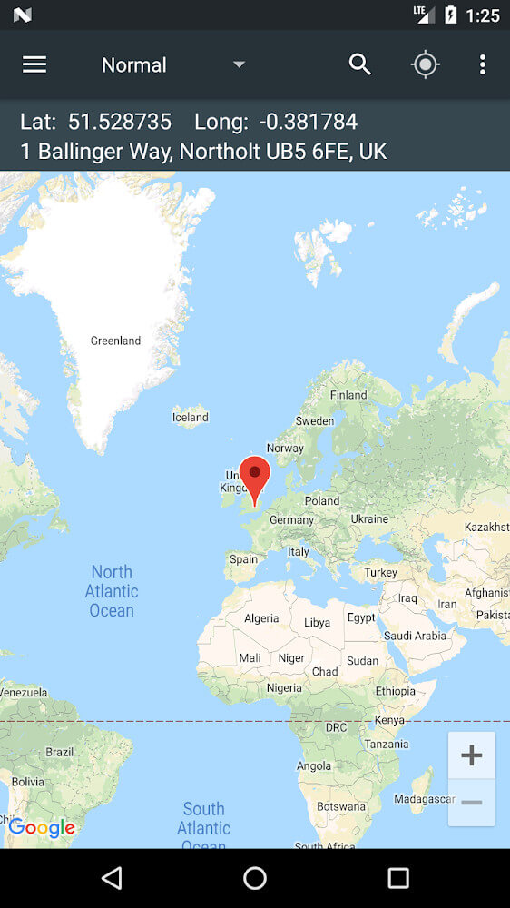
Map Coordinates is a location data and advanced map interaction tool. With a detailed user interface, a comfortable and advanced user interface, and an AI assisted search, all built to handle complex data, these tools help users perform deep and broad searches. Targeting the user’s needs, it provides access to the latest available map data to assist users in quickly obtaining the exact location they need, either at work or for personal use. The tools also offer an easy and stress free way to transition between complex data layers. With this maps application, users can easily switch between different data layers and view complex coordinate information, while still being able to use the maps effectively. The design of the application is simple and built to let users focus on a certain location of the map without offering too many different tools. The application wants to give all users a comfortable interaction, no matter the reason for using it, from a casual map user, to a professional mapping user.
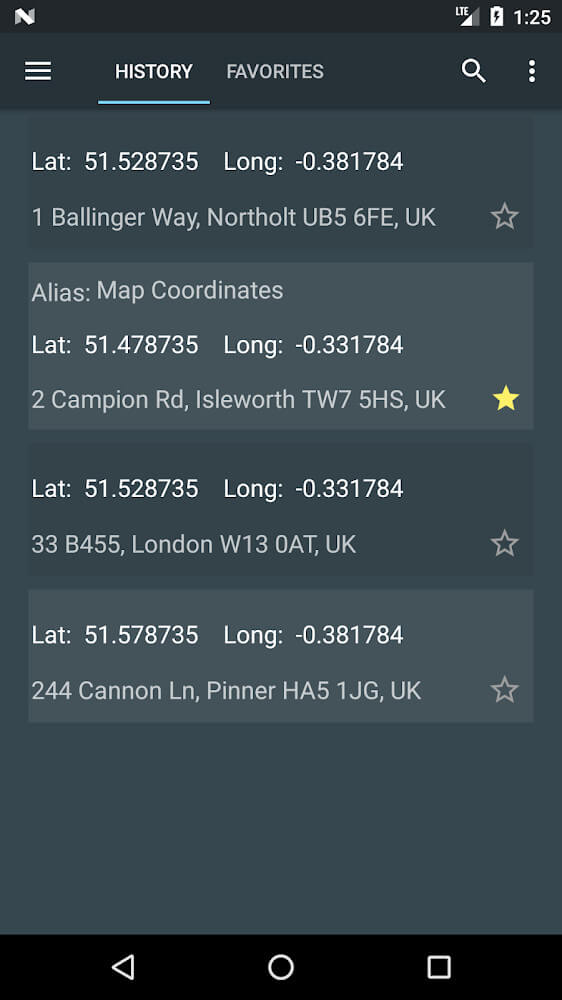
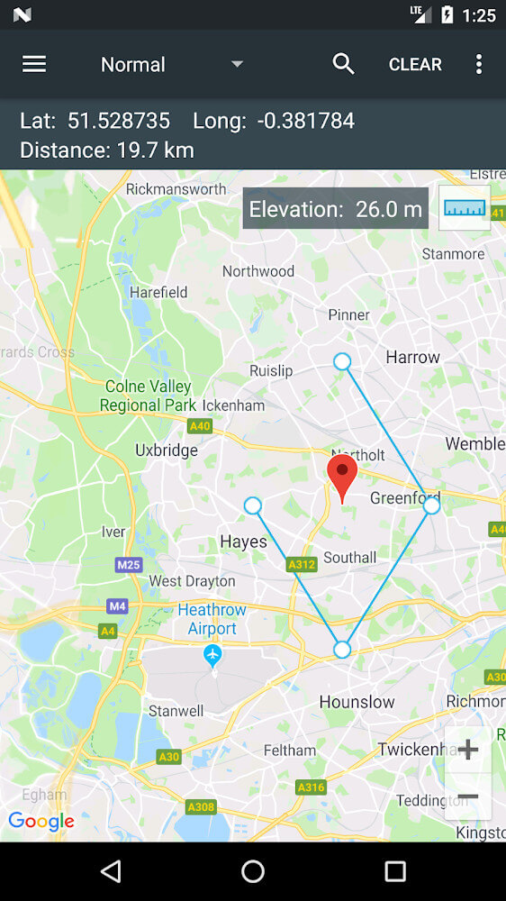
The app offers additional mapping tools that go beyond just finding a location. Tools include measuring distances. The app also identifies important location parameters critical for decision-making during navigation. Users have the ability to record log their trips. Each log entry is detailed and includes a point and accompanying time and date. The points can be exported as compressed files that include the time and date stamps for each point, along with an image that includes the point for visual reference. The app is able to identify segments of road and document the type of vehicle and speed. This allows reverse navigation by users to specific locations. The combination of these features makes the application a good tool for location reporting. Data pertaining to a location are able to be sent in compressed files in real-time. Data can also be forwarded in a readily viewable file format. The application is able to combine geospatial data in a centralized form. The application’s utility extends to the formatted data that can be forwarded to others. The application can be a good replacement for GPS loggers if reporting to others is desired in a compressed format.
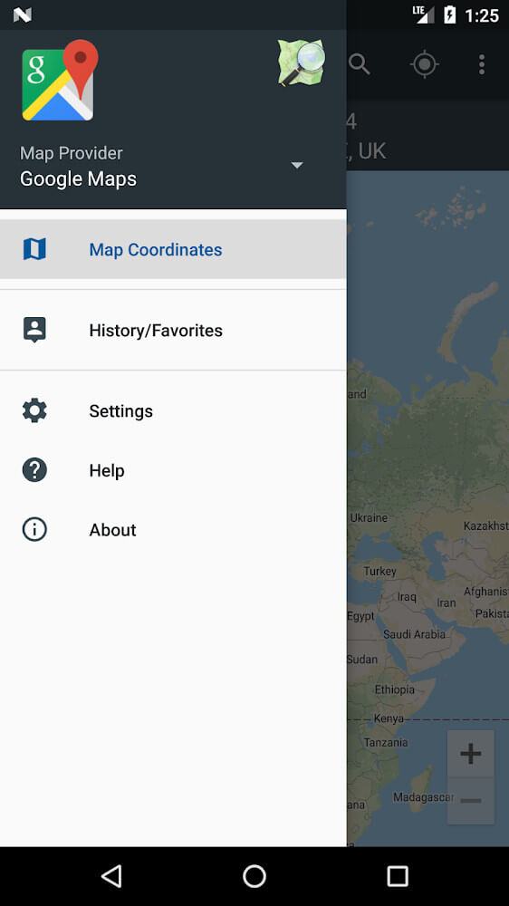
The 3D map functionality is a major feature of this solution, employing the latest tech to help people check altitudes and visualize terrain. This feature is highly applicable to hiking and camping in forests as it helps you understand individual sections of the trail in terms of elevation to ensure safety. The application has been built to work offline, thus allowing you to use the 3D mapping functionality without the need for internet. Users have the ability to instantly switch between various mapping providers including Google Maps and other local datasets. This feature does not disrupt the search process and therefore does not slow down the user. The instant switching between mapping providers ensures that at no time are users limited to the data of a single provider. This feature of the solution allows users to instantly switch between providers without any loss of data or resetting progress. It further allows users to navigate easily through cities or even remote wilderness areas.
The application was designed to let users adjust and share data. GPS data can be shared as files via different methods, making the application collaborative for group or work activities. The system is able to store, read, and write data in several formats via different systems using different formats. Once data is input, users can create several markers of locations that can be sent to their friends and colleagues. Since it utilizes many map services and providers, if one map service is not sufficient for a particular region, the user can switch to a different map service that has more detailed data. While a user is switching map service providers, the search data is not affected, giving users a sense of comfort when using the application. Map Coordinates is a sophisticated application in that it has real-time data and navigation in a 3D view where the user can manipulate the 3D view to understand a navigation system in unfamiliar land and complex terrain. The user can create travel logs to save their navigation data in the application to enhance user experience and safety in navigation.
Key features
- Lookup locations by address or specific coordinate
- Distance measurement tools for precise navigation
- Exportable reports and GPS data sharing
- Travel history logs with plain text and image support
- 3D map view with altitude checking for hiking and camping
- Offline functionality for remote navigation
- Support for multiple map providers including Google Maps
- Real-time data updates without interaction resets
- Customizable interface designs and interaction modes
- Speed and vehicle change markers within travel logs
 |
 |
Related MOD APKs
FAQ
Is Premium unlocked in Map Coordinates MOD APK?
This 5.8.4 version of Map Coordinates features Premium Unlocked. Other features work like the Soft Stack Dev release, and changes are active as soon as you install.
What is the latest version of Map Coordinates MOD APK?
The 5.8.4 build matches the Soft Stack Dev release last updated on September 22, 2025. We don’t keep older versions here. To update, install this build from this page over your existing one; if Android reports a signature conflict, uninstall first.
Is Map Coordinates MOD APK safe to download?
On MODYOLO, this 5.8.4 build of Map Coordinates is the Soft Stack Dev app with Premium Unlocked. 3 users gave it a 4 rating here. It does not require root. A Play Protect warning is expected; always download from this page.
Can I use Map Coordinates MOD APK on PC or iPhone?
This Android package will not work on iPhone or iPad. On Windows or macOS you can run the 13M APK using an emulator like BlueStacks or LDPlayer—just install the software and drag the file in.